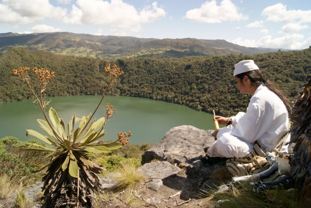
Guatavita Lagoon with Muisca Indigenous Storyteller
Muisca Indigenous Storyteller
3119 m
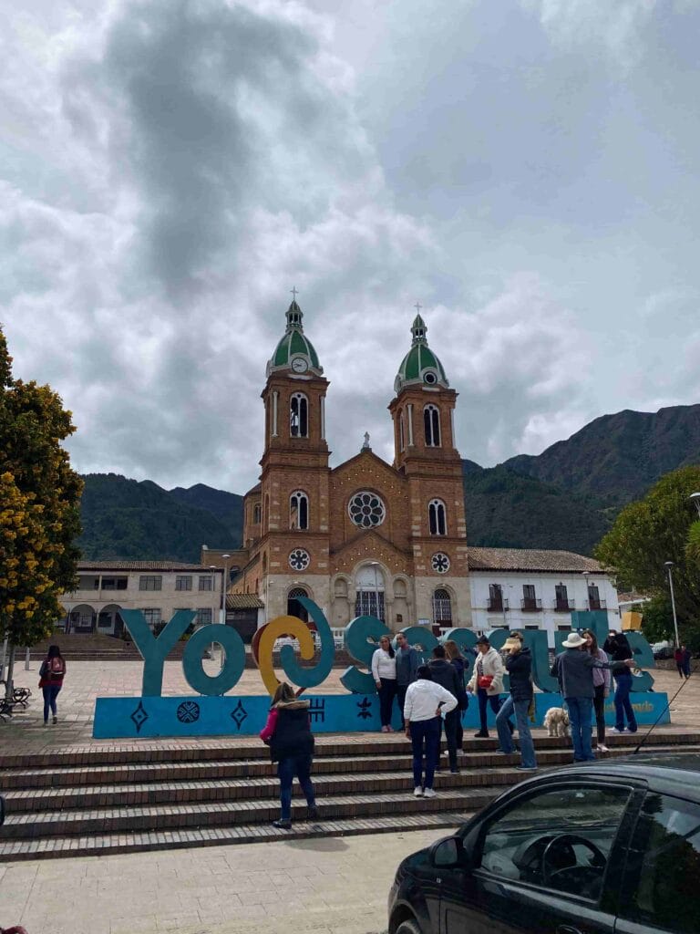
Main Square of Sesquilé
Spanish
Description
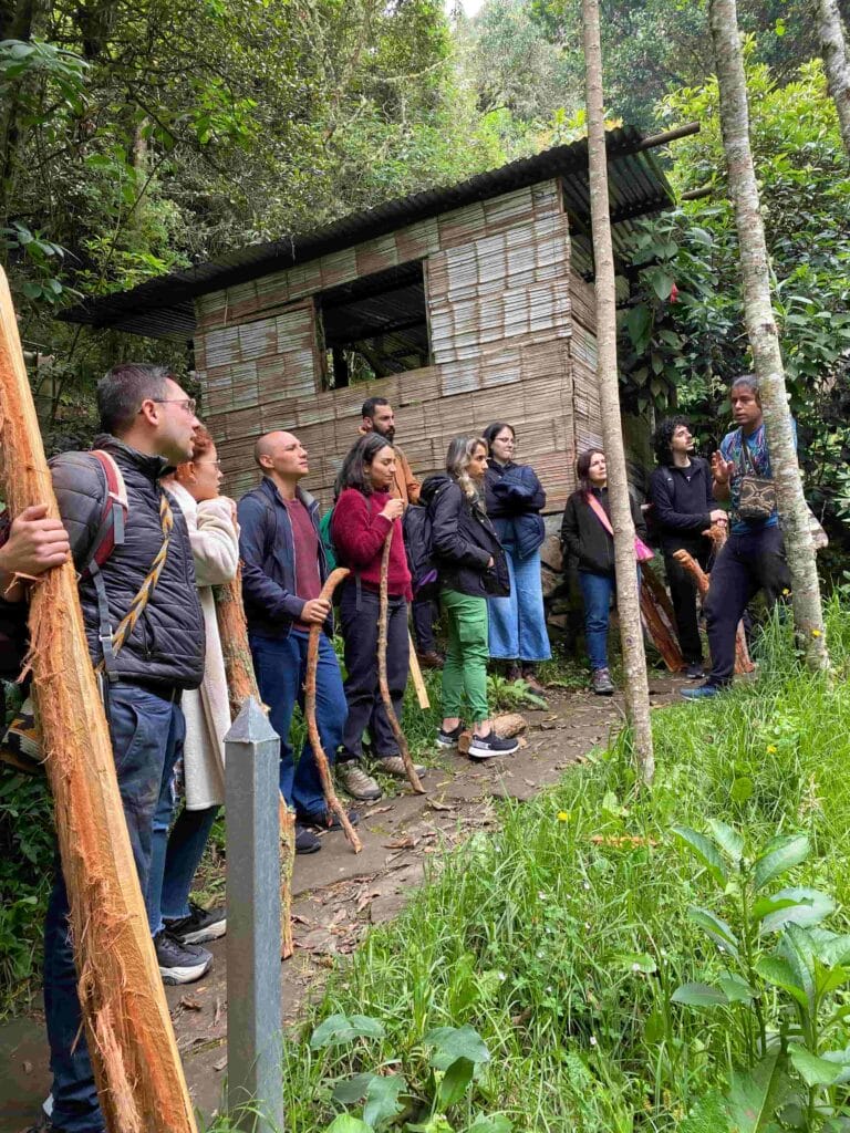
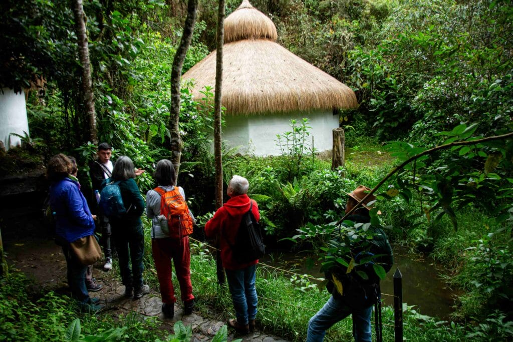
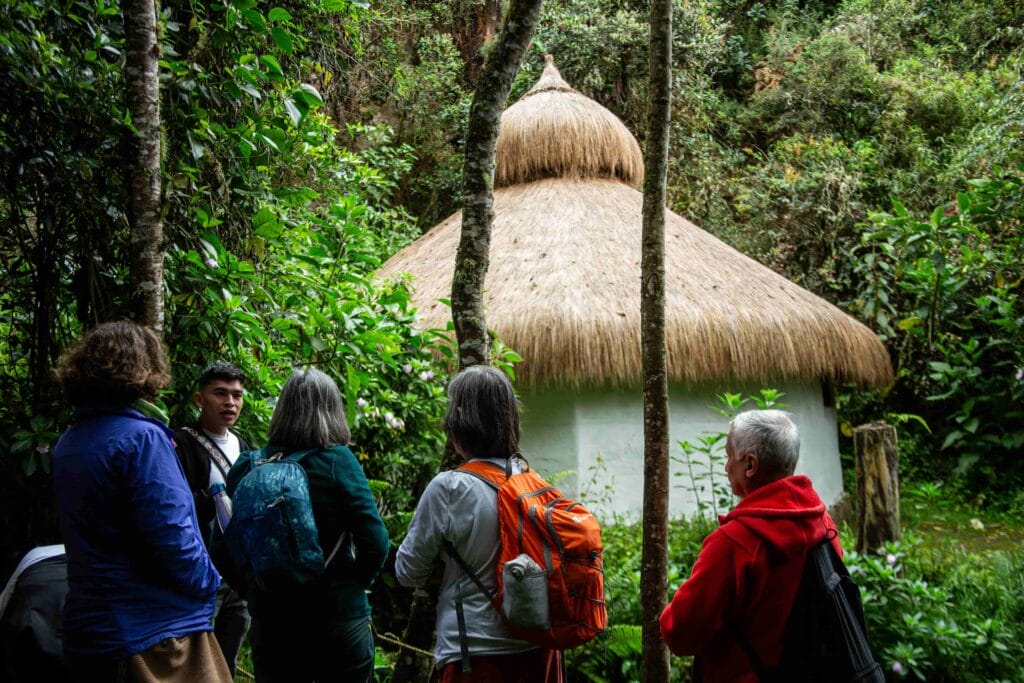
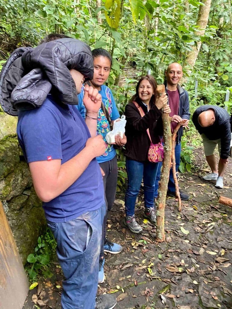
The experience to the Lagoon of Cacique Guatavita, guided by indigenous leaders from the Mhuysqa Chuta fa Aba Reservation – the children of corn, and the storytelling of their cosmovision, the TYGUA AÏE – Eagle Path experience, will immerse participants in the mystical atmosphere of the Guatavita Lagoon, the navel of the world. This legendary place is filled with history and myths, such as the secret of El Dorado. It also offers the opportunity to participate in traditional activities, visit ceremonial houses, and learn about the history and worldview of the reservation.
Activity: Learn about the Mhuysqa Indigenous worldview Difficulty: Low Distance: 200 meters Time: 1 hour
Mhuysqa Chuta fa Aba Reservation – the children of corn
Activity: Hike, cultural activities, and meals at the reservation Difficulty: Low Distance: 4 km (round trip) Maximum Altitude: 2700 meters above sea level Temperature: 9 to 13°C Time: 2 hours
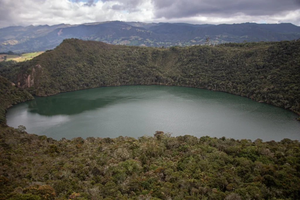
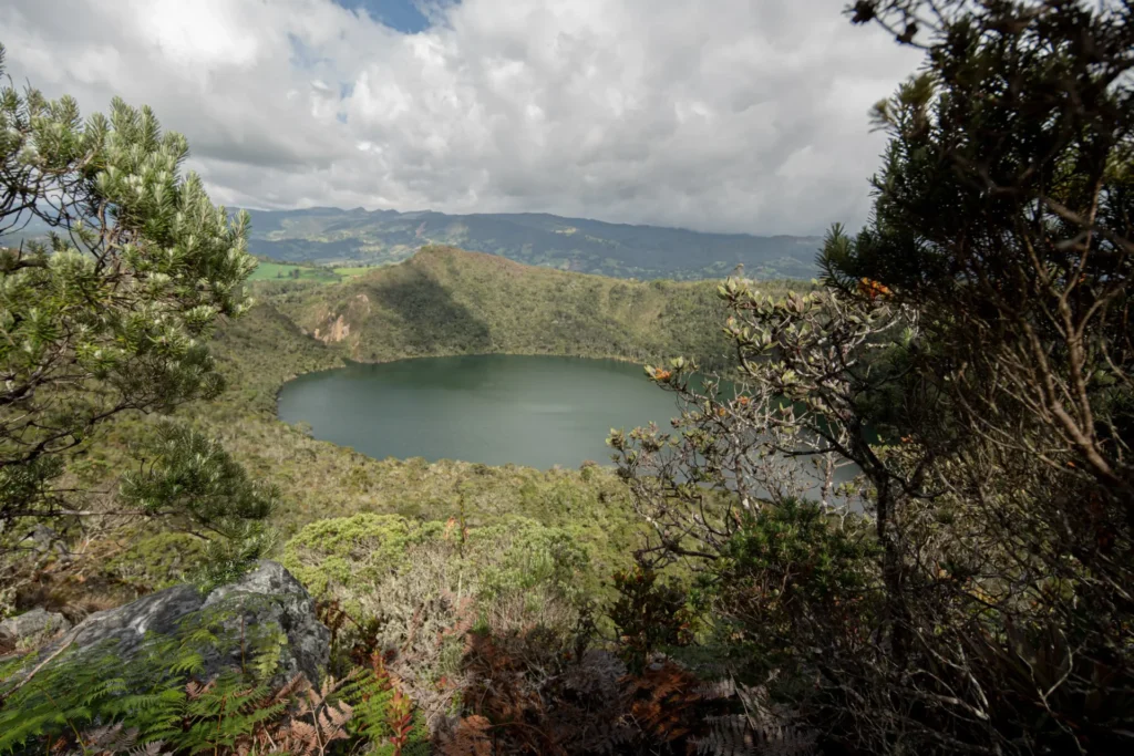
Lagoon of Cacique Guatavita
Activity: Trekking Difficulty: Low Distance: 2 km Maximum Altitude: 3119 m.
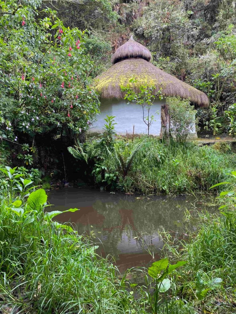
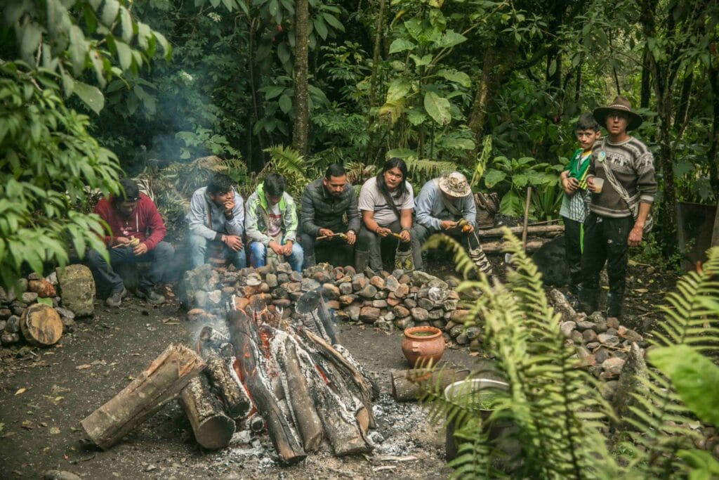
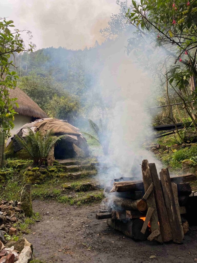
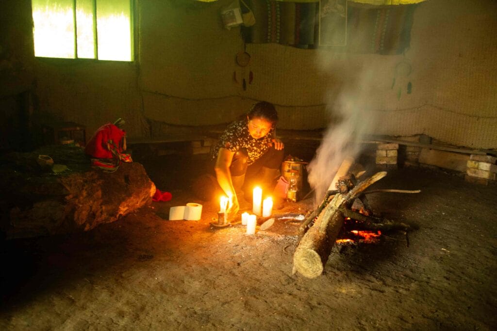
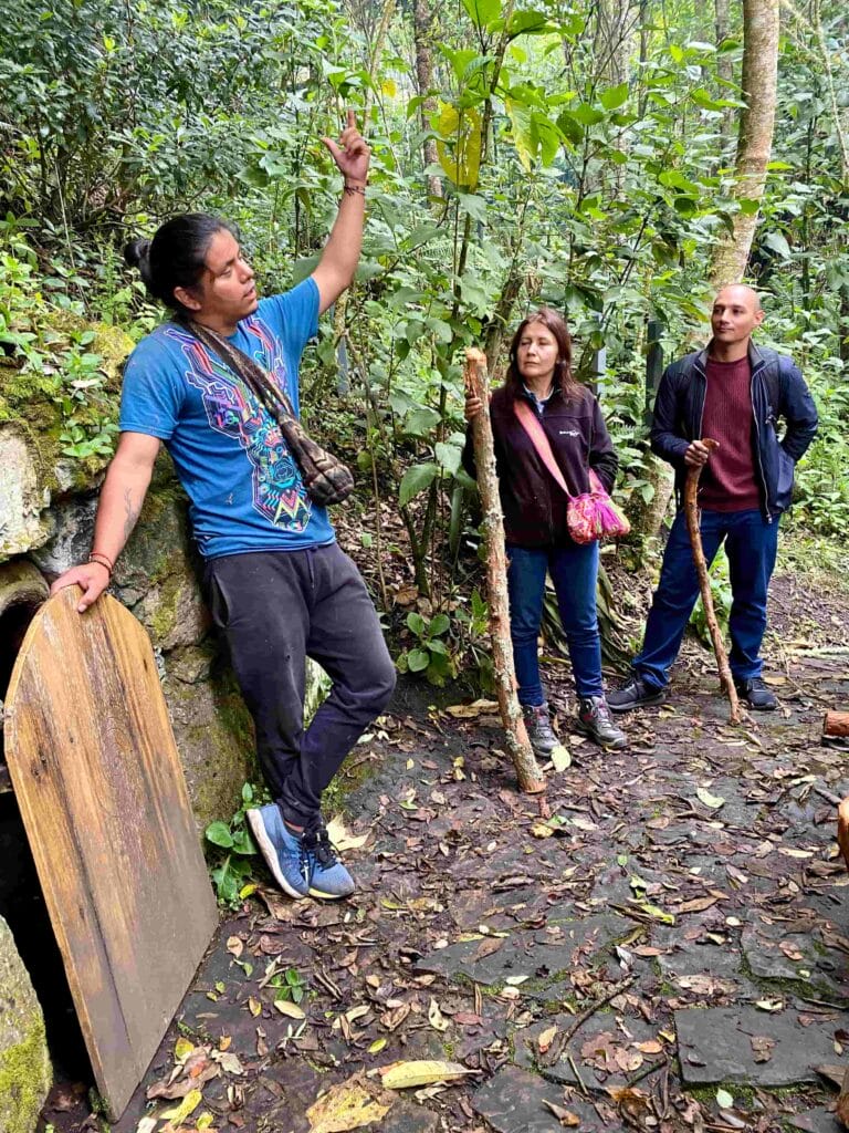
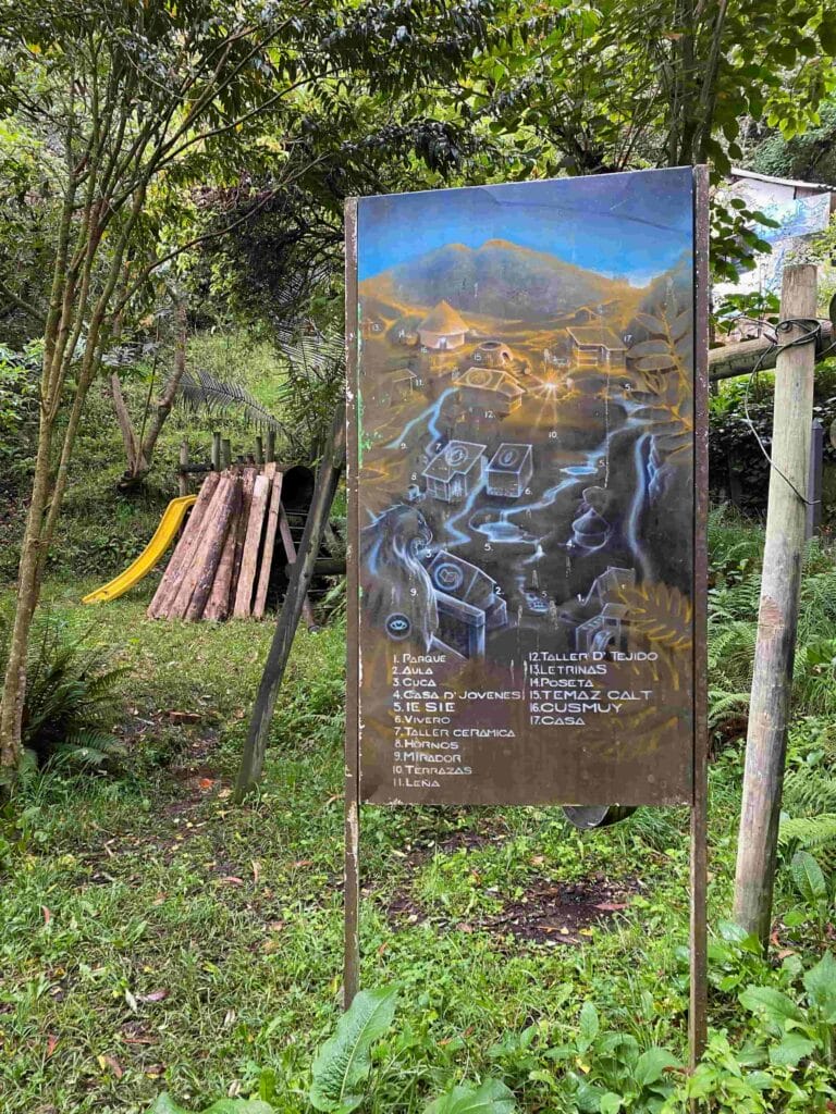
Cultural activities included in this experience are: 1. Immersive and interpretive circuit to ceremonial places and representative spaces such as the Ie Canuca Misua Path – the path that crosses dreams, Cuca, Ceremonial Houses, Temazcal, Qusmuy, and the Water House. 2. Word circle around the fire in the Qusmuy. 3. Payment ritual. 4. Palabreo: origin of the Temazcal Ceremony. 5. Myths of the origin of the Guatavita Lagoon.
Interpretive tour of the Lagoon of Cacique Guatavita.
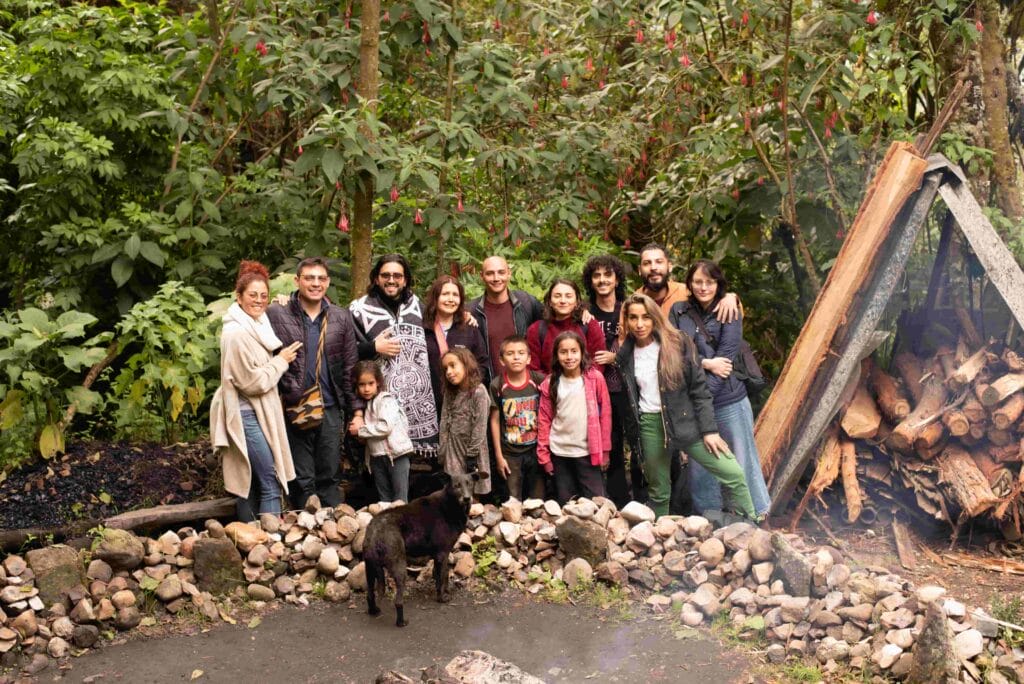
Visit the Muisca Indigenous Reservation of Sesquilé, the Children of Corn (Mhuysqa Chuta fa Aba Reservation).
Immersion in the ceremonial places of the community.
Interpretive tour of each of the cosmogony murals by the Muisca indigenous artists in the town of Sesquilé.
Walk along the IE CANUCA MISUA path (the path that crosses dreams) and visit the ceremonial houses. Includes palabreo of the origin of the temazcal ceremony.
Interpretive tour of the Lagoon of Cacique Guatavita, guided by a Muisca indigenous storyteller who will explain the history and sacred significance of the lagoon for the community.
This experience does not include the traditional medicine of the Muisca indigenous community, the Hosqa IE. However, you can see the Temazcal experience which does include it. The cleansing ceremony with tobacco and cotton does not involve consuming it.
The indigenous community loves receiving visits from the whole family. Keep in mind that it is a mountain and the walk is uphill. It is recommended that if you come with children, they should be older than 7 years.
Of course, your pet will be very happy to receive the beautiful energy of the place.
Date Availability
Every day from Monday to Sunday. We can organize your visit for any day of the week.
17% Off
FromUSD$60
USD$50
/ Adult
Effortless Reservation Process. - ( No booking hassles )
Transparent Pricing, Zero Surprises. - ( No hidden costs )
Expertise Beyond Measure.
Reviews
Pamela Ruth
mayo de 2024
Read More
I arrived late but they accomodated me well. Guide suggested my taxi take us up hill to save time and it is really up the hill and at high altitude @2600 m so taxi really helped. Still got a nice walk around their villagr and good explanation of their world view in communal hut. As a bonus my young guide told me why the muisga skeleton in the bogota gold museum had her wrists tied and put up under her chin. Skeleton was bundled in a bag and I thought it was to prevent her getting out of woven sack and roaming as ghost.Nope. She was buried in fetal position and placed back in mother earth like baby. Also he told me what some pictographs I had seen at El Abra day before meant. Not touristy and good iour if you like to learn native lore as I do.
Being guided by someone native to an indigenous tribe was a spectacular experience. It really makes you experience the museum in a different way and learn a lot about the customs of the tribe.
Javier Alejandro
marzo de 2024
Read More
I really like it! It's a mixture between a spiritual experience and a touristic one. We were impressed with the wisdom and dedication they had. I greatly recommend it for anyone interested in getting in touch with the pre-Hispanic roots of Colombia and Latin America overall . I would love to go back with more people!
Temazcal ceremony and the private tour by Kalaira was an incredible and unique opportunity in my path, meeting ancestral Muisca community is a unique experience in Colombia. One in a lifetime experience with an spiritual guide is such and amazing experience. This is the real temazcal ceremony, you don't need to look somewhere else other than Kalaira.
Thank you Kalaira for allowing me to live this wonderful experience, with a beautiful group and with the Muisca community in Sesquile. I honor the brotherhood of men, women and children who pursue a spiritual life, based on unity, creative work and the contemplation and care of nature.
Thank you, thank you, thank you 🤩
Ana
marzo de 2024
Read More
Amazing experience! Thank you Toti for all the knowledge you shared with us. We truly enjoyed it.
Ryan
abril de 2024
Read More
Great place
Previous
Next
Difficulty levels definition
Scroll down to see all difficulty levels.
Grade
Description
Length
Elevation Gain
Terrain
Altitude
Experience
Recommended Physical Condition
Example
A+
Extremely Difficult
More than 30 km (19 miles)
More than 1,500 m (4,900 feet)
Very steep terrain, light climbing, areas without defined trails